WASHINGTON – Newly released satellite images show the devastating flooding contaminated by pollution from Hurricane Florence’s pounding of the Carolinas, including waste from the hundreds of industrial-scale hog and poultry farms in North Carolina’s coastal plain. Photos from the U.S. Geological Survey starkly demonstrate the consequences of concentrating confined animal feeding operations, or CAFOs, in low-lying areas along sensitive flood plains.
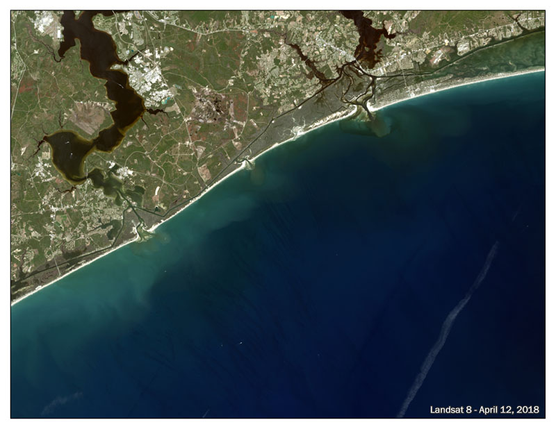
Here are before-and-after photos of the coastline near Marine Corps Base Camp Lejeune on April 12 and September 19, after the storm left at least 24 dead and dumped near-record amounts of rainfall.
April 12:
September 19:
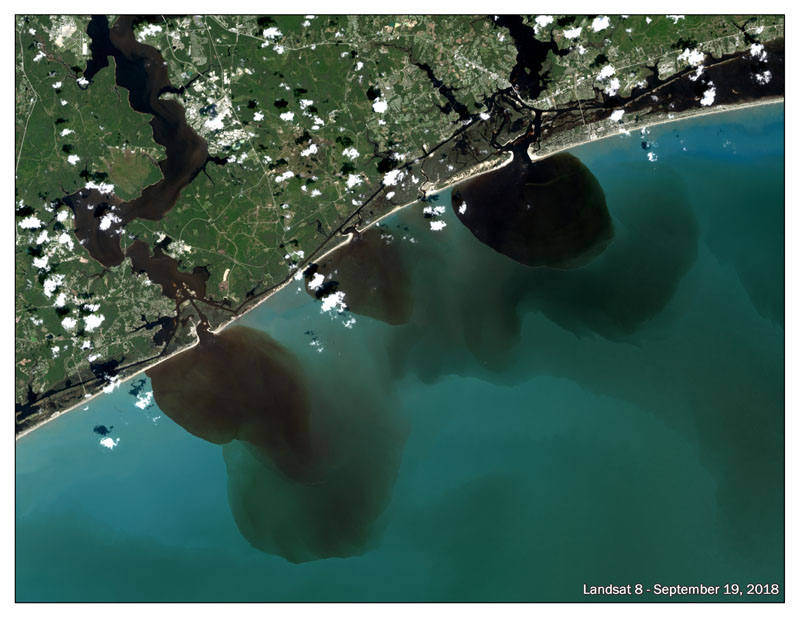
The dark brown liquid spilling into the Atlantic captured in this image is a mix of rainwater, riverbed sediment and waste from those factory farms within the 100-year flood plain that were inundated with more than 20 inches of rain in the matter of a couple of days.
“Not every picture is worth a thousand words, but these two are,” said Craig Cox, EWG’s senior vice president for agriculture and natural resources. “Images like this and others showing swamped animal barns and flooded waste pits are a glaring reminder that letting industrial agriculture determine how and where it operates can cause serious public health and environmental damage.”
North Carolina houses over 2,200 hog CAFOs and more than 3,900 poultry CAFOs, many of which stood directly in Florence’s path. EWG estimates these facilities can produce up to 10 billion gallons of waste a year.
Analysis by EWG researchers showed that twenty-one swine CAFOs in or within 100 feet of the flood plain received 20 or more inches of rain between Sept. 14 and Sept. 16. These farms are capable of producing over 78 million gallons of animal waste in one year.
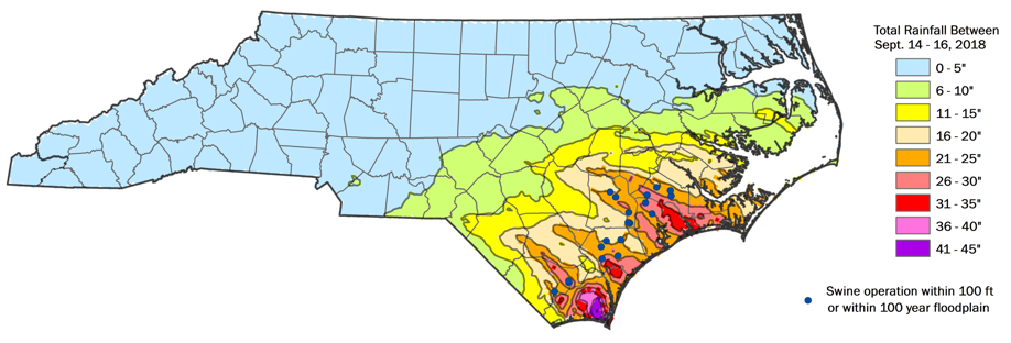
Source: EWG, from National Weather Service data
“These 21 factory farms are just the tip of the iceberg,” said Cox. “Hundreds of open-air hog waste pits were hit with more rain than they were designed to handle. And the manure applied to fields as farmers rushed to empty their pits is flowing into waterways along with rainwater.”
The contaminated water is likely to linger for weeks after flood waters recede.
Next week EWG and the Waterkeeper Alliance will release updated mapping showing the impacts of Hurricane Florence on the more than 6,100 CAFOs in North Carolina.